The project Anthropocene Territories is a multi-media and multidisciplinary project by Territorial Agency developed with GLUON and VITO.
The project is to identify the Anthropocene territory of the river Scheldt (Belgium), as it is being transformed by the ultra-rapid rise of human activities that marks the departure from the stable climate of the Holocene period. This is a territory that connects the waters of the Channel and North Sea to the low-lying and shallow waters of the estuary and delta. It is a new kind of territory that is shaped by the intensification of the material, energy and information fluxes that form the basis for human activity— the technosphere that now operates as a main planetary component of the Earth System. It is a territory that would not have been possible during the formation of its lands that built outwards during the Holocene, when sea level during the three millennia prior to industrialization varied little more than 0.1 m.

Today we are in the early stages of inundation of these territories, with an expected sea level rise of more than 2m in the next century, and extensive land being within the first metre rise within the 21st Century. This new condition affects both the structures of the lands formed during the Holocene, that now lie at, or just above or below sea level.
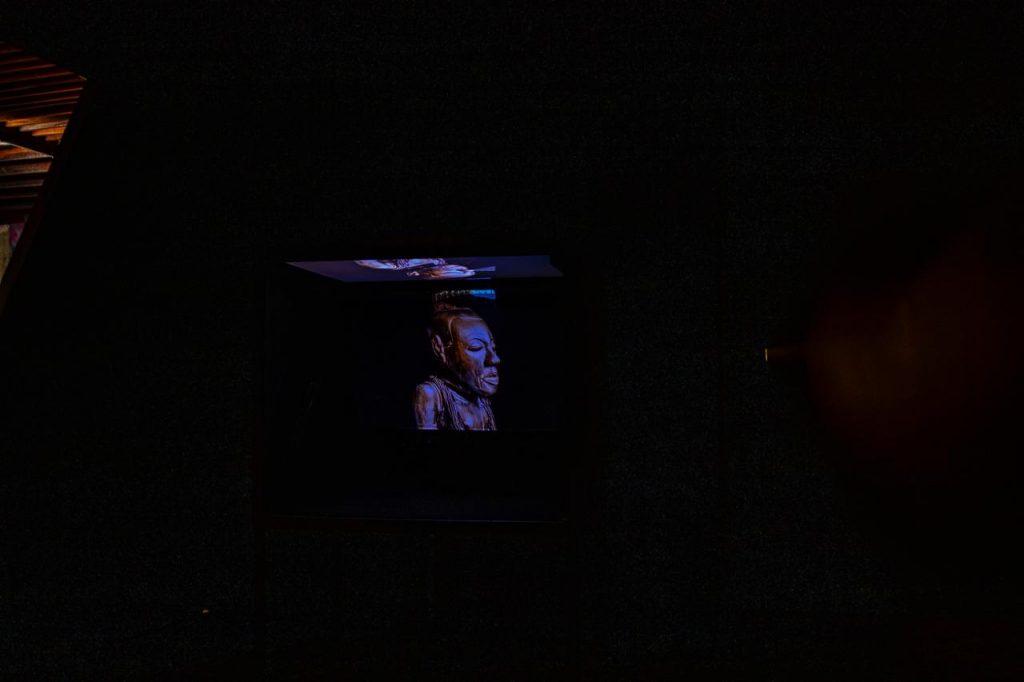
Anthropocene Territories uses remote sensing images from satellites and from drones to depict how the areas affected are both the most urbanised, and the most sensitive components of our living planet. The final outcome is an AI prototype tool to connect Earth Observation data to other fields of inquiry.
Artist: Territorial Agency: John Palmesino (IT), Ann-Sofi Rönnskog (FI)
Residency Support Network:


About Territorial Agency
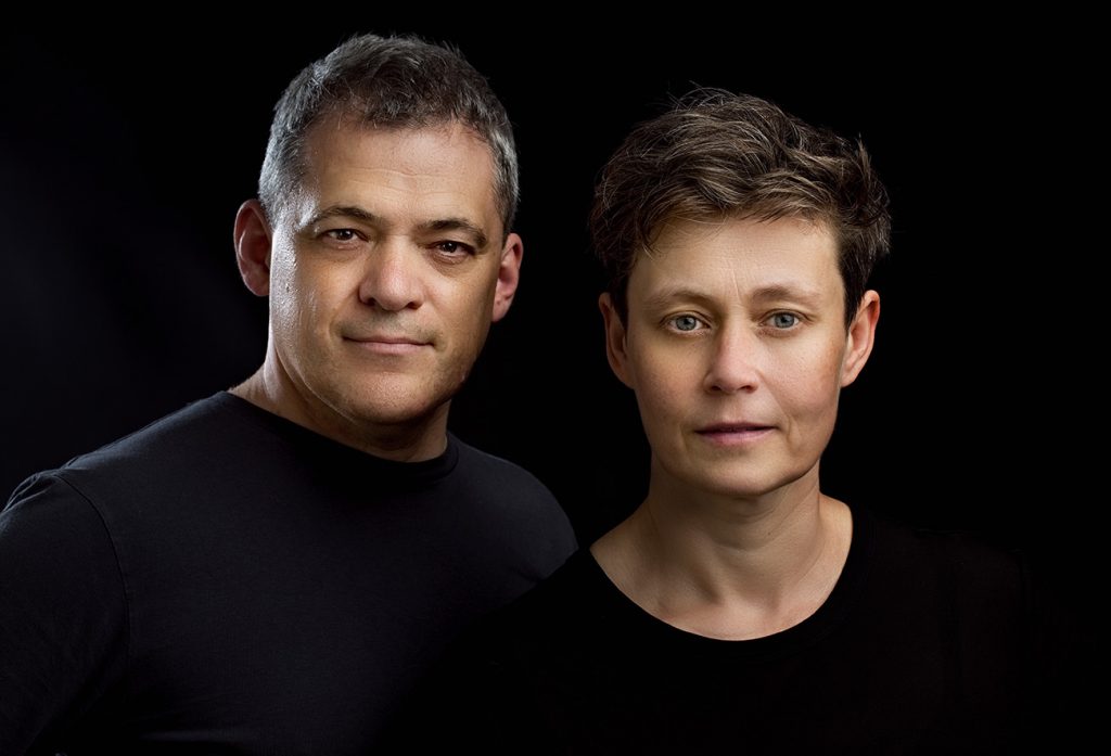
John Palmesino and Ann-Sofi Rönnskog are architects and urbanists. They are the founders of Territorial Agency (INT), an independent organisation that combines contemporary architecture, science, art, advocacy and action. Territorial Agency is a leader in the development of architecture’s relation to the Anthropocene, with projects including How heavy is a city?, Oceans in Transformation, Sensible Zone, Plan the Planet, Museum of Oil and Anthropocene Observatory. They are recipients of the STARTS Grand Prize of the European Commission honouring innovation in technology, industry and society stimulated by the arts. They are the chief curators of the Lisbon Triennale 2025, and members of the high-profile interdisciplinary Anthropocene Working Group.
Hiroaki Yamane is an accomplished designer, creative technologist, architect, photographer and a true code poet. With Hiro, precision of intent and openness to further development are always on the table.
Host / Region
GLUON / Brussels, Belgium – Port Of Antwerp-Bruges
Abstract
This residency focused on the interconnected economic, residential, and natural ecosystems surrounding the Port of Antwerp-Bruges. It aims to create artistic outputs that engage communities and promote future sustainable water management through more-than-human perspectives.
Keywords
sea level rise, ecocentrism, biodiversity, interspecies ethics, pollution, water quality
Description of the regional challenge
The Port of Antwerp-Bruges, situated in Flanders, Belgium, serves as the city’s primary maritime gateway. Located mainly within the province of Antwerp and partly in East Flanders, it is Europe’s second-largest seaport, positioned at the upper reaches of the Scheldt river’s tidal estuary.
As a global economic artery, the port, the city, and the interlinked partners face urgent challenges in governing their numerous water challenges. Water quality and pollution, sediment management,the loss of biodiversity and disruption of aquatic habitats, sea level rise and flood rise, water resource management, and ballast water management contribute to the spread of invasive species.
How is the mission S+T+ARTS driven?
Endorsed by the Worldwide Network of Port Cities AIVP and supported by STARTS4waterII coordinator Vito as well as Brussel’s hub for artistic research GLUON, an artist can explore concrete water challenges around the Antwerp area, engaging with biotopes, experts and engineers to add reflection and depth to the water management challenges.
Future port developments can adopt ecocentric planning approaches, involve diverse stakeholders, and prioritise biodiversity conservation, sustainable practices, and ethics of care. This shift of values emphasises the interconnectedness and intrinsic value of non-human entities within port ecosystems. Artist can highlight new perspectives highlighting value shifts that otherwise might remain absent. In collaboration with different players in the port she can engage communities through artistic interventions and contribute to public education and environmental stewardship.
The result of the residency will be shown during the Love Tomorrow Conference at Tomorrowland Festival 2025.
About The Project – ANTHROPOCENE TERRITORY SCHELDT
ANTHROPOCENE TERRITORY SCHELDT – In the Anthropocene, new territories traverse, diffract and scatter pre-existing ones. The Scheldt is transforming rapidly due to the intensification of human activities, marking a departure from the stable Holocene period. The concept of territory spans multiple disciplines, from biology and geology to politics and economics. The project aims to identify the Anthropocene territory of the Scheldt, linking the Channel and North Sea waters with the estuary and delta, now shaped by intensified material, energy, and information fluxes. With rising sea levels, increased presence of neobiota, and the impact of human construction, this territory faces significant transformations. The project uses remote sensing technologies to create dynamic images, integrating data over time to illustrate these transformations. These images serve as tools for experts and the general public to understand and address the Scheldt’s challenges, facilitating collaboration and new narratives. The project emphasizes the aesthetic and political dimensions of remote sensing, aiming to foster a shared understanding of Scheldt’s Anthropocene territory and support diplomatic negotiations in this space in transformation.